


Voting District 101, Craig County, Oklahoma
About
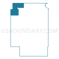
Outline

Summary
| Unique Area Identifier | 653858 |
| Name | Voting District 101 |
| County | Craig County |
| State | Oklahoma |
| Area (square miles) | 42.14 |
| Land Area (square miles) | 42.13 |
| Water Area (square miles) | 0.01 |
| % of Land Area | 99.98 |
| % of Water Area | 0.02 |
| Latitude of the Internal Point | 36.94003340 |
| Longtitude of the Internal Point | -95.36259410 |
Maps


Graphs
Select a template below for downloading or customizing gragh for Voting District 101, Craig County, Oklahoma


Neighbors
Neighoring Voting District (by Name) Neighboring Voting District on the Map
- Voting District 130, Craig County, OK
- Voting District 301, Nowata County, OK
- Voting District 304, Nowata County, OK
- Voting District 320, Craig County, OK
- Elm Grove Township Voting District, Labette County, KS
- Howard Township Voting District, Labette County, KS
Top 10 Neighboring County Subdivision (by Population) Neighboring County Subdivision on the Map
- North Craig CCD, Craig County, OK (3,061)
- South Coffeyville-Wann CCD, Nowata County, OK (2,220)
- Lenapah-Delaware CCD, Nowata County, OK (1,682)
- Elm Grove township, Labette County, KS (823)
- Howard township, Labette County, KS (346)
Top 10 Neighboring Elementary School District (by Population) Neighboring Elementary School District on the Map
Top 10 Neighboring Unified School District (by Population) Neighboring Unified School District on the Map
- Labette County Unified School District 506, KS (7,770)
- Oklahoma Union Public Schools, OK (2,950)
- Welch Public Schools, OK (1,882)
Top 10 Neighboring State Legislative District Lower Chamber (by Population) Neighboring State Legislative District Lower Chamber on the Map
- State House District 6, OK (35,997)
- State House District 10, OK (35,320)
- State House District 7, KS (19,922)
Top 10 Neighboring State Legislative District Upper Chamber (by Population) Neighboring State Legislative District Upper Chamber on the Map
Top 10 Neighboring 111th Congressional District (by Population) Neighboring 111th Congressional District on the Map
Top 10 Neighboring Census Tract (by Population) Neighboring Census Tract on the Map
- Census Tract 3731, Craig County, OK (3,061)
- Census Tract 9506, Labette County, KS (2,296)
- Census Tract 1721, Nowata County, OK (2,220)
- Census Tract 1722, Nowata County, OK (1,682)